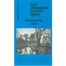
Staffordshire Sheet 67.05 Wombourne 1900 - published 2000; introduction by Angus Dunphy
This detailed map covers a largely rural area SW of Wolverhampton, of which the main feature is the village of Wombourne.
Features include St Benedict's church, Old Bush Inn, Duneden, Greenhill House, Rushford Slang, The Wodehouse, The Foxhills,, Woody Park. On the reverse we include a portion of adjacent sheet 67.09 extending coverage south to include Himley Hall. A directory of Wombourne is also included.
Wombourne 1900 - Old Ordnance Survey Maps - The Godfrey Edition
- Brand: Alan Godfrey Maps
- Product Code: St67.05
- Availability: 3
-
£3.50
Related Products
Sedgley (West) 1900 - Old Ordnance Survey Maps - The Godfrey Edition
Staffordshire Sheet 67.06 Sedgley (West) 1900 - published 1997; introduction by Angus Dunphy We h..
£3.50
WOMBOURNE St. Benedict Biscop Parish register transcripts - Bap and Mar 1726-1837, BTs and bur 1673-1837 Indexed (download)
WombourneThese files contain details of the Parish Registers ofSt Benedict BiscopBaptisms (1678..
£12.50
WOMBOURNE St. Benedict Biscop Parish register transcripts. Indexed and Monumental Inscriptions - Bulk buy (download)
WOMBOURNE St. Benedict Biscop Save money and buy both Parish register and Monumental Inscription ..
£16.50
Sedgley (West) 1938 - Old Ordnance Survey Maps - The Godfrey Edition
Staffs Sheet 67.06b Sedgley (West) 1938 - published 2014; intro by Malcolm Nixon.ISBN.978-..
£3.50
Tags: wombourne


