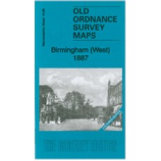
Warwickshire Sheet 13.08a Birmingham (West) 1887 - published 2012; intro by Barrie Trinder. ISBN.978-1-84784-604-4 
We have published two versions of this busy map, showing how the area changed across the years. Coverage stretches from Rotton Park Reservoir eastward to Bingley Hall and King Alfred's Place, and from Spring Hill southward to Five Ways and Hagley Road.
The map includes the Ladywood area and has a marked contrast between the cramped streets of terraces and back-to-backs of Ladywood and the more spacious detached houses on the south side of Hagley Road, at the foot of the map. The busy Broad Street area is included. Features include Birmingham Canal, Birmingham Canal (Old Line), various branch canals, LNWR Stour Valley Railway with Monument Lane station, goods stations and engine sheds, Harborne Branch with Icknield Port Road station, tramways, Children's Hospital, Grammar School, Queen's Hospital, Bingley Hall, skating rinks, Assembly Rooms, Prince of Wales Theatre, many engineering works and other workshops, Palace Theatre, St John's church, The Oratory, RC High School, Summerfield Park, schools, Lower Edgbaston Reservoir, etc and much else. On the reverse we include a selection of street directory entries.
The 1887 version is fully coloured, taken from the beautiful 1st Edition OS handcoloured edition.
Birmingham (West) 1887 - Coloured - Old Ordnance Survey Maps - The Godfrey Edition
- Brand: Alan Godfrey Maps
- Product Code: Wk13.08A
- Availability: 3
-
£4.00
Related Products
Edgbaston 1901 - Old Ordnance Survey Maps - The Godfrey Edition
Here are the details of maps for Edgbaston:Warwicks 13.12a Edgbaston 1887 - published 2012; intro by..
£3.50
Winson Green and Hockley 1903 - Old Ordnance Survey Maps - The Godfrey Edition
Here are the details of maps for Hockley & Birmingham NW:Warwicks Sheet 13.04a Winson Green &..
£3.50
Bearwood 1903 - Old Ordnance Survey Maps - The Godfrey Edition
Here are the details of maps for Bearwood:Staffordshire 72.07a Bearwood 1903 - published 1986; intro..
£3.50
Edgbaston 1887 - Coloured - Old Ordnance Survey Maps - The Godfrey Edition
Here are the details of maps for Edgbaston:Warwicks 13.12a Edgbaston 1887 - published 2012; intro by..
£4.00
Winson Green and Hockley 1888 - Old Ordnance Survey Maps - The Godfrey Edition
Here are the details of maps for Hockley & Birmingham NW:Warwicks Sheet 13.04a Winson Green &..
£3.50
Birmingham Central 1913 - Old Ordnance Survey Maps - The Godfrey Edition
Here are the details of maps for central Birmingham: Warks Sheet 14.05a Central Birmingham 1888 -..
£3.15 £3.50
Birmingham Central 1902 - Old Ordnance Survey Maps - The Godfrey Edition
Here are the details of maps for central Birmingham:Warwicks Sheet 14.05a Central Birmingham 1888 - ..
£3.50
Whiteheath Gate 1914 - Old Ordnance Survey Maps - The Godfrey Edition
Here are the details of maps for Whiteheath Gate:Staffs 72.01 Whiteheath Gate 1902 - published 1989;..
£3.50
Bearwood 1913 - Old Ordnance Survey Maps - The Godfrey Edition
Here are the details of maps for Bearwood:Staffordshire 72.07a Bearwood 1903 - published 1986; intro..
£3.50
Winson Green and Hockley 1914 - Old Ordnance Survey Maps - The Godfrey Edition
Here are the details of maps for Hockley & Birmingham NW:Warwicks Sheet 13.04a Winson Green &..
£3.50
Edgbaston 1914 - Old Ordnance Survey Maps - The Godfrey Edition
Here are the details of maps for Edgbaston:Warwicks 13.12a Edgbaston 1887 - published 2012; intro by..
£3.50


