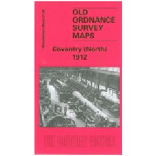
Warwickshire Sheet 21.08 Coventry (North) 1912 - published 2006; introduction by Malcolm Nixon.
The Coventry North map covers an area around Foleshill Road and Stoney Stanton Road,with coverage stretching from Harnall Lane East northward to Great Heath, Paradise and Highfield Street; and from Sandy Lane eastward to Stoke Heath and Barras Heath. Features on this very busy map include the Coventry Canal, tramways and tram depot, mineral railway leading to ordnance factory, Bishopsgate Green, King Field ribbon works, Swanswell Ward, Harnall Ward, Courtauld's Artificial Silk factory, Daimler's Motor Mill, and much more. On the reverse is a section of the 1921 Directory, A-G.
Coventry (North) 1912 - Old Ordnance Survey Maps - The Godfrey Edition
- Brand: Alan Godfrey Maps
- Product Code: Wk21.08
- Availability: 1
-
£3.50
Related Products
Coventry (West) 1904-11 - Old Ordnance Survey Maps - The Godfrey Edition
Warwickshire Sheet 21.11 Coventry (West) 1904-11 - published 2006; introduction by Malcolm..
£3.50
Coventry (South) 1912 - Old Ordnance Survey Maps - The Godfrey Edition
Warwickshire Sheet 21.16 Coventry (South) 1912 - published 2006; introduction by Malcolm N..
£3.50
Coventry 1905 - Old Ordnance Survey Maps - The Godfrey Edition
Warwickshire Sheet 21.12 Coventry 1905 - published 1996; introduction by Alan Godfrey T..
£3.50
Illustrative Papers On The History & Antiquities Of The City Of Coventry, 1871 - Download
Note - Once you have paid, your order will be passed to Midland Historical Data who will send you a ..
£13.99
Coventry 1887 coloured - Old Ordnance Survey Maps - The Godfrey Edition
21.12a Coventry 1887 - published 2013; intro by Barrie Trinder. ISBN.978-1-8478..
£4.00
Kenilworth 1903 - Old Ordnance Survey Maps - The Godfrey Edition
Warwickshire Sheet 26.10 Kenilworth 1903 - published 2013; intro by Malcolm Nixon. ISBN.978-1-84784-..
£3.50
Coventry Christ Church Parish Register images - Bap 1875-1908, Mar 1892-1915 - Indexed (Download)
Coventry Christ Church Parish Registers These are copies of the original images from the par..
£6.00
Coventry St Mark Parish Register images - Bap 1869-1904, Mar 1869-1905 - Indexed (Download)
Coventry St Mark Parish Registers These are copies of the original images from the parish re..
£28.00
Coventry Keresley St Thomas Parish Register images - Bap 1849-1913, Mar 1849-1901 - Indexed (Download)
Coventry Keresley St Thomas Parish Registers These are copies of the original images from th..
£30.00
Coventry All Saints Parish Register images - Bap 1869-1903, Mar 1869-1912 - Indexed (Download)
Coventry All Saints Parish Registers These are copies of the original images from the parish regi..
£19.00
Stoke, Coventry Parish Register images - Bap 1573-1915, Mar 1573-1907, Bur 1573-1853 - Some gaps - Indexed (Download)
Stoke, Coventry Parish RegistersIncluding Surname IndexThese are copies of the original images ..
£25.00
Coventry, Holy Trinity, Parish Register Transcripts; Bapt. 1561-1837, Banns 1653-1661, Mar. 1561-1837, Bur. 1561-1839 Plus MIs - Download
Coventry, Holy Trinity, Parish Register Transcripts Including a Searchable Surname Index and link..
£14.00
Tags: coventry


