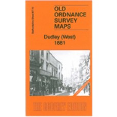
Staffs Sheet 67.15a Dudley (West) 1881 - published 2013; intro by Angus Dunphy. ISBN.978-1-84784-657-0 
We have published two versions of this map, showing how the area changed across the years. The 1881 version is coloured, taken nbfrom nthe beautiful OS 1st Ediytion handocloured map.
The maps cover the western part of Dudley town, including the Old Dock area, and coverage extends westward to the Old Park area, southward to Scotts Green and Blowers Green. Other districts mentioned include Thornleigh Collieries, Springs Mire, New Dock, Sunnyside. The area is split between Staffordshire and Worcestershire, and doubles as Worcs sheet 1.15.
Features include tramways, short stretch of GWR OWW line, several mineral railways, Yorkspark Colliery (disused), Thornleigh Works, old mine shafts, public baths, St Luke's church, schools, Russell's Hall, Himley Colliery, Graveyard Farm, Parkhead Colliery (disused), St Augustine's church, expanses of old industrial sites and coalfield, etc.
The map links up with sheets 67.11 Gornal to the north, 67.14 Shut End to the west, 67.16 Dudley to the east, 71.03 Round Oak to the south.
Dudley (West) 1881 (Coloured Edition) - Old Ordnance Survey Maps - The Godfrey Edition
- Brand: Alan Godfrey Maps
- Product Code: St67.15A
- Availability: 1
-
£4.00
Related Products
Dudley St. Edmund Staffordshire Parish Registers
St. Edmund Dudley Staffordshire Parish Registers Baptisms, Marriages & Burials 1540-1..
£3.00
Gornal and Wren's Nest 1901 - Old Ordnance Survey Maps - The Godfrey Edition
Staffordshire Sheet 67.11 Gornal & Wren's Nest 1901 - published 1998; introduction by ..
£3.50
Dudley Castle and Tipton Green 1901 - Old Ordnance Survey Maps - The Godfrey Edition
Here are the details of maps for Dudley (North):Staffordshire 67.12a Dudley Castle & Tipton..
£3.50
Shut End and Tansey Green 1903 - Old Ordnance Survey Maps - The Godfrey Edition
Staffordshire Sheet 67.14 Shut End & Tansey Green 1903 - published 2006; introduction ..
£3.50
Dudley (West) 1901 - Old Ordnance Survey Maps - The Godfrey Edition
Staffordshire Sheet 67.15 Dudley (West) 1901 - published 1991; introduction by Robin Pears..
£3.50
Dudley 1901 - Old Ordnance Survey Maps - The Godfrey Edition
Staffordshire Sheet 67.16 Dudley 1901 - published 1997; introduction by David Radmore &..
£3.50
Round Oak 1901 - Old Ordnance Survey Maps - The Godfrey Edition
Here are the details of maps for Round Oak:Staffs Sheet 71.03a Round Oak 1901 - published 2000; intr..
£3.50
Dudley (West) 1881 (Coloured Edition) - Old Ordnance Survey Maps - The Godfrey Edition
Staffs Sheet 67.15a Dudley (West) 1881 - published 2013; intro by Angus Dunphy. ISBN.978-1..
£4.00
Dudley St Thomas Parish Register Transcripts - Baptisms, Marriages & Burials 1541-1649 (download)
Dudley St Thomas Parish Register TranscriptsNow with digital index Baptisms, Marriages ..
£3.50
Dudley - Rowley Regis - 1851 census Staffordshire - Download
Dudley - Rowley Regis - 1851 census Staffordshire Piece HO107/2028 This download contains..
£3.00 £6.75
Dudley Castle and Tipton Green 1913 - Old Ordnance Survey Maps - The Godfrey Edition
Here are the details of maps for Dudley (North):Staffordshire 67.12a Dudley Castle & Tipton..
£3.50
Round Oak 1914 - Old Ordnance Survey Maps - The Godfrey Edition
Here are the details of maps for Round Oak:Staffs Sheet 71.03a Round Oak 1901 - published 2000; intr..
£3.50
Dudley, St. Edmund; Baptisms 1540-1646, Marriages 1542-1644 and Burials 1540-1671 (download)
Dudley, St. Edmund Parish register transcripts Baptisms (1540 – 1646)Marriages (1542 – 1644)Bur..
£4.00
1891 Census Surname Index. Parts of Staffordshire - Download
1891 Census Surname Index forRG12/2223 to 2244and2287 to 2298Tettenhall RG12/2223Kinver RG12/2224Wom..
£10.00
Tags: dudley


