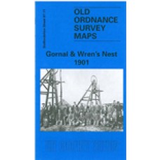
Staffordshire Sheet 67.11 Gornal & Wren's Nest 1901 - published 1998; introduction by Angus Dunphy
This detailed map covers the NW part of Dudley incl Shavers End and London Fields; coverage continues westward to Lower Gornal, northward to Upper Gornal. The map doubles as Worcestershire sheet 1.11.
Features on the map include Dudley Workhouse, tramways, football ground, Russell's Hall, Woodsellor's Farm, Wren's Nest Hill, Old Priory Farm, London Fields Works, Dibdalebank, Dibdale Works, Graveyard, Dibdale Colliery, Upper Gornal Colliery, Ruiton, brick works, old coal shafts etc. The map is less industrial than most others in the area. On the reverse we include directories of Upper and Lower Gornal.
Gornal and Wren's Nest 1901 - Old Ordnance Survey Maps - The Godfrey Edition
- Brand: Alan Godfrey Maps
- Product Code: St67.11
- Availability: 1
-
£3.50
Related Products
Sedgley (SE) with Swan Village and West Coseley 1901 - Old Ordnance Survey Maps - The Godfrey Edition
Staffordshire Sheet 67.07 Sedgley (SE) with Swan Village & West Coseley 1901 - published 1997; i..
£3.50
Gornalwood and Himley Coalfield 1901 - Old Ordnance Survey Maps - The Godfrey Edition
Staffordshire Sheet 67.10 Gornalwood & Himley Coalfield 1901 - published 199; introduc..
£3.50
Dudley Castle and Tipton Green 1901 - Old Ordnance Survey Maps - The Godfrey Edition
Here are the details of maps for Dudley (North):Staffordshire 67.12a Dudley Castle & Tipton..
£3.50
Dudley (West) 1901 - Old Ordnance Survey Maps - The Godfrey Edition
Staffordshire Sheet 67.15 Dudley (West) 1901 - published 1991; introduction by Robin Pears..
£3.50
Dudley (West) 1881 (Coloured Edition) - Old Ordnance Survey Maps - The Godfrey Edition
Staffs Sheet 67.15a Dudley (West) 1881 - published 2013; intro by Angus Dunphy. ISBN.978-1..
£4.00
Sedgley (SE) & West Coseley 1938 - Old Ordnance Survey Maps - The Godfrey Edition
Staffs Sheet 67.07b Sedgley (SE) & West Coseley 1938 - published 2015; intro by Malcol..
£3.50
Dudley Castle and Tipton Green 1913 - Old Ordnance Survey Maps - The Godfrey Edition
Here are the details of maps for Dudley (North):Staffordshire 67.12a Dudley Castle & Tipton..
£3.50
Tags: gornal, wren's nest


