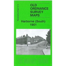
Warwickshire Sheet 13.15 Harborne (South) 1901 - published 2009; introduction by Malcolm Nixon
The map also includes Worcestershire sheet 5.15. This detailed map covers the southern part of Harborne and northern fringe of Northfield. Coverage stretches from Victoria Road southward to Weoley Park Farm and the northern tip of Selly Oak Park; and from Metchley Lane westward to Barnes Hill.
Features include St Peter's church, Harborne Hall, Mill Farm, Dudley Canal, California area, site of Weoley Castle, Metchley Grange, The Grove, Harborne House, Gravel Bank, Welsh House Farm etc. On the reverse we include street directory entries for Harborne Lane, Metchley Lane, Northfield Road, Old Church Road, St Mary's Road, St Peter's Road and Victoria Road.
Harborne (South) 1901 - Old Ordnance Survey Maps - The Godfrey Edition
- Brand: Alan Godfrey Maps
- Product Code: Wk13.15
- Availability: 2
-
£3.50
Related Products
Harborne 1901 - Old Ordnance Survey Maps - The Godfrey Edition
Here are the details of maps for Harborne:Warwicks Sheet 13.11a Harborne 1901 - published 1989; intr..
£3.50
Bournbrook 1902-11 - Old Ordnance Survey Maps - The Godfrey Edition
Here are the details of maps for Bournbrook:Warwicks Sheet 13.16a Bournbrook 1902-11 - published 199..
£3.50
Quinton 1902 - Old Ordnance Survey Maps - The Godfrey Edition
Worcestershire Sheet 5.10 Quinton 1902 - published 1993; introduction by John Maddison ..
£3.50
Griffin's Hill 1902 - Old Ordnance Survey Maps - The Godfrey Edition
Worcestershire Sheet 10.03 Griffin's Hill 1902 - published 2009; introduction by Malcolm N..
£3.50
Harborne 1938 - Old Ordnance Survey Maps - The Godfrey Edition
Here are the details of maps for Harborne:Warwicks Sheet 13.11a Harborne 1901 - published 1989; intr..
£3.50
Harborne 1914 - Old Ordnance Survey Maps - The Godfrey Edition
Here are the details of maps for Harborne:Warwicks Sheet 13.11a Harborne 1901 - published 1989; intr..
£3.50
Bournbrook & Birmingham University 1914 - Old Ordnance Survey Maps - The Godfrey Edition
Here are the details of maps for Bournbrook:Warwicks Sheet 13.16a Bournbrook 1902-11 - published 199..
£3.50


