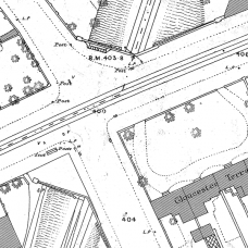
Birmingham Ordnance Survey map XIV.6.21
Main Streets – Arthur Street, Bordesley Park Road, Butler Street, Cattell Road, Coventry Road, Dart Street, Greenway Street, Herbert Road, Kingston Road, Miles Street, Regent Park Road,
Places – Aston Place, Bellevue Place, Berkley Place, Blandford House, Bordesley Park Terrace, Bowling Green Terrace, Bromsgrove Terrace, Burbidge Place, Clifton Terrace, Coventry Road Police Station, Durnford Place, Gloucester Terrace, Greenway Terrace, Herbert Place, Kingston Terrace, Ladybird Terrace, Leicester Terrace, Lorne Terrace, Louis Terrace, M.R. Bristol & Birmingham, Mount Pleasant, Mount Pleasant Grove, Mount Terrace, Pleasant Place, Providence Place, Regent Park Place, Regent Place, Sutton Place, The Grove, The Retreat, Ventnor Place, Warwick Place, Weston Place,
Public Houses/Hotels – Greenway Arms, Prince Arthur, Regent Park Tavern, Small Heath Tavern,
Churches –
Schools –
Post Code District – Birmingham B10
This is a downloadable PDF file, approx. 12MB
Birmingham c.1888 street maps - detailed to individual house level
Each map is to a scale of 1:500 (10 feet to 1 mile) which covers an approximate area of about 500 yards by 350 yards. This enables pillar boxes, lamp posts and garden details to be clearly seen. When linked to addresses in censuses, old photographs and other records, you can begin to build a picture of your ancestors surroundings and environment.
To find a complete list of maps available in the Birmingham maps collection, please click here.
File will be available as soon as you have paid, go to Account, then select downloads
Data is in PDF format and is viewable on any PC using Adobe Acrobat Reader
Also readable on a MAC or Linux systems with the appropriate version of Adobe Acrobat Reader.
Please contact us if you need any more information
Birmingham Ordnance Survey map XIV.6.21 and 21A - Download
- Brand: Midland Ancestors
- Product Code: BH-XIV.6.21
- Availability: 10
-
£5.00
Related Products
Birmingham Ordnance Survey map XIV.5.1 - Download
Birmingham Ordnance Survey map XIV.5.1Main Streets - Lionel Street, Livery Street, Ludgate Str..
£5.00
Birmingham Ordnance Survey map XIV.5.19 - Download
Birmingham Ordnance Survey map XIV.5.19Main Streets – Adderley Street, Alcester Street, Allcock Str..
£5.00
Tags: Birmingham-Maps


