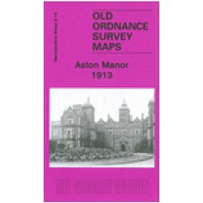
Warwickshire Sheet 8.13 Aston Manor 1913 - published 2002; introduction by Alan Godfrey
This detailed map covers the heart of the large Aston Manor, including parts of Aston, Handsworth and Lozells Wards, as well as the area known as Birchfield. Coverage stretches from Stamford Road eastward to Beales Street and Electric Avenue, and from Deykin Avenue southward to Clifton Road. It is a busy map and features include Aston Hall, Aston Park, Villa Park, LNWR line with Witton station, St Peter & St Paul's church, Bathurst Works, Howard Chandelier Works, tramways and depot, St Paul's church Lozells, Holy Trinity church Birchfield, many streets of mostly terraced housing, St James church, Lozells Picture House, Holte Almshouses, Pavilion Electric Theatre, Grammar School, police station, etc etc. On the reverse we include a selection of street directory entries, incl Birchfield Road, Frederick Road, Queen's Road, Witton Lane, Witton Road.
Aston Manor 1913 - Old Ordnance Survey Maps - The Godfrey Edition
- Brand: Alan Godfrey Maps
- Product Code: Wk08.13
- Availability: 4
-
£3.50
Related Products
Handsworth 1913 - Old Ordnance Survey Maps - The Godfrey Edition
Warwickshire Sheet 7.16 Handsworth 1913 - published 2002; introduction by Alan Godfrey This detai..
£3.50
Gravelly Hill 1902 - Old Ordnance Survey Maps - The Godfrey Edition
Warwickshire Sheet 8.14 Gravelly Hill 1902 - published 2001; introduction by Alan Godfrey This de..
£3.50
Birmingham (North) 1913 - Old Ordnance Survey Maps - The Godfrey Edition
Warwickshire Sheet 14.01 Birmingham (North) 1913 - published 1997; introduction by John Boynton T..
£3.50
Perry Barr 1902 - Old Ordnance Survey Maps - The Godfrey Edition
Staffordshire Sheet 69.09 Perry Barr 1902 - published 2001; introduction by Alan Godfrey ..
£3.50
Aston St. Peters and St. Pauls - Church Photo - Download
Aston, St. Peters & St. Pauls Church Photo Photo available as a downloadable digital imag..
£3.00
Aston St. Peter And St. Paul's Church - Monumental Inscriptions - Download
Monumental Inscriptions Aston, St. Peter And St. Paul's Church This is a downloadable pdf file..
£7.50
Aston Juxta St.Peter and St.Paul parish register transcripts (download)
Aston Juxta (near Birmingham) St.Peter and St.Paul Baptisms, Marriages and Burials 1544-1640 ..
£4.00
Birmingham (North) 1902 - Old Ordnance Survey Maps - The Godfrey Edition
Warwickshire Sheet 14.01a Birmingham (North) 1902 - published 2013; intro by Mike Jee. ISB..
£3.50
Birmingham East 1888 coloured - Old Ordnance Survey Maps - The Godfrey Edition
Here are the details of maps for Birmingham (East):Warwicks 14.06a Birmingham (East) 1888 - publishe..
£4.00
Gravelly Hill 1886 Coloured - Old Ordnance Survey Maps - The Godfrey Edition
Warwicks 8.14a Gravelly Hill 1886 - published 2017; intro by Barrie Trinder. ISBN.978-1-78721-034-9&..
£4.00
Gravelly Hill 1913 - Old Ordnance Survey Maps - The Godfrey Edition
Here are the details of maps for Gravelly Hill:Warwicks 8.14a Gravelly Hill 1886 - published 2017; i..
£3.50
Tags: aston


