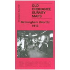
Warwickshire Sheet 14.01 Birmingham (North) 1913 - published 1997; introduction by John Boynton
This detailed map covers a very busy area of north Birmingham, with coverage stretching from Barr Street and Great Hampton Street eastward to Bloomsbury Street, and from Tower Road southward to Great Brook Street. The map includes the Aston New Town area, much of Duddeston, and Gosta Green. It is a map crowded with terraces and back-to-back houses, along with many small iron works and the like.
Features include the LNWR Aston Goods Branch with goods station and gas works, Birmingham & Fazeley Canal, Digbeth Branch canal, tramways and depot, Perryian Pen Works, vinegar brewery, Holt Brewery, Walmer Recreation Ground, Dunlop Rubber Works, Climax Tube Works, Hockley Brook, St George's church, Constitution Hill, St Mary's Ward, Aston Cross, etc. Some of the housing must have been desperately overcrowded. On the reverse include street directory entries for Aston Road, Aston Road North, Dartmouth Street, Pritchett Street, Tower Road, Tower Street.
Birmingham (North) 1913 - Old Ordnance Survey Maps - The Godfrey Edition
- Brand: Alan Godfrey Maps
- Product Code: Wk14.01B
- Availability: 4
-
£3.50
Related Products
Winson Green and Hockley 1903 - Old Ordnance Survey Maps - The Godfrey Edition
Here are the details of maps for Hockley & Birmingham NW:Warwicks Sheet 13.04a Winson Green &..
£3.50
Aston Manor 1913 - Old Ordnance Survey Maps - The Godfrey Edition
Warwickshire Sheet 8.13 Aston Manor 1913 - published 2002; introduction by Alan Godfrey This deta..
£3.50
Birmingham (Saltley) 1902 - Old Ordnance Survey Maps - The Godfrey Edition
Warwickshire Sheet 14.02 Birmingham (Saltley) 1902 - published 2003; introduction by John Gough T..
£3.50
Business Directory of Birmingham, J. S. C. Morris (1862) - Download
Note - Once you have paid, your order will be passed to Midland Historical Data who will send you a ..
£13.99
Centenary of the Birmingham Library, 1779-1879 - Download
Note - Once you have paid, your order will be passed to Midland Historical Data who will send you a ..
£13.99
Catalogue of the Birmingham Library (1883) - Download
Note - Once you have paid, your order will be passed to Midland Historical Data who will send you a ..
£13.99
Winson Green and Hockley 1888 - Old Ordnance Survey Maps - The Godfrey Edition
Here are the details of maps for Hockley & Birmingham NW:Warwicks Sheet 13.04a Winson Green &..
£3.50
Ward End 1902 - Old Ordnance Survey Maps - The Godfrey Edition
Warwicks Sheet 14.03 Ward End 1902 - published 2014; intro by Malcolm Nixon. ISBN.978-1-84..
£3.50
Stechford 1902 - Old Ordnance Survey Maps - The Godfrey Edition
Warwicks Sheet 14.07 Stechford 1902 - published 2014; intro by Malcolm Nixon. ISBN.978-1-8..
£3.50
Birmingham Central 1913 - Old Ordnance Survey Maps - The Godfrey Edition
Here are the details of maps for central Birmingham: Warks Sheet 14.05a Central Birmingham 1888 -..
£3.15 £3.50
Birmingham (Saltley) 1913 - Old Ordnance Survey Maps - The Godfrey Edition
Here are the details of maps for Birmingham (NE): Warwicks Sheet 14.02a Birmingham (Saltley) 1902..
£3.50
Birmingham (Saltley) 1886 (Coloured Edition) - Old Ordnance Survey Maps - The Godfrey Edition
Here are the details of maps for Saltley & Nechells:Warwicks Sheet 14.02a Birmingham (Saltley) 1..
£4.00
Birmingham Central 1902 - Old Ordnance Survey Maps - The Godfrey Edition
Here are the details of maps for central Birmingham:Warwicks Sheet 14.05a Central Birmingham 1888 - ..
£3.50
Aston Manor 1938 - Old Ordnance Survey Maps - The Godfrey Edition
Here are the details of maps for Aston & Birchfield:Warwickshire 8.13a Aston Manor 1913 - publis..
£3.50
Winson Green and Hockley 1914 - Old Ordnance Survey Maps - The Godfrey Edition
Here are the details of maps for Hockley & Birmingham NW:Warwicks Sheet 13.04a Winson Green &..
£3.50


