Worcestershire Maps

Alan Godfrey Maps for Worcestershire
Kidderminster and Stourport on Severn - Cassini Past and Present Map - 4 maps from 4 periods
Kidderminster and Stourport on Severn Cassini Map - Past and Present series - 4 maps from 4 ..
£7.99
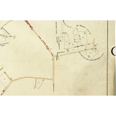
Tidmington Tithe map 1842 - CR569-243 (Download)
Tidmington Tithe map 1842 - CR569-243 High quality images, includes transcriptions of the apporti..
£30.00
Alvechurch 1903 - Old Ordnance Survey Maps - The Godfrey Edition
Here are the details of maps for Alvechurch:Worcestershire 16.11 Alvechurch 1903 - published 2023; i..
£3.50
Bewdley 1926 - Old Ordnance Survey Maps - The Godfrey Edition
Worcestershire Sheet 14.01 Bewdley 1926 - published 2004; introduction by Barrie Trinder ..
£3.50
Bromsgrove 1926 - Old Ordnance Survey Maps - The Godfrey Edition
Worcestershire Sheet 15.16 Bromsgrove 1926 - published 2004; introduction by Malcolm Nixon..
£3.50
Coombeswood 1914 - Old Ordnance Survey Maps - The Godfrey Edition
Worcestershire Sheet 5.09 Coombeswood 1914 - published 1998; introduction by Angus Dunphy ..
£3.50
Cradley (South) 1901 - Old Ordnance Survey Maps - The Godfrey Edition
Worcestershire Sheet 4.12 Cradley (South) 1901 - published 2001; introduction by Angus Dun..
£3.50
Droitwich (North) 1901 - Old Ordnance Survey Maps - The Godfrey Edition
Worcestershire Sheet 22.14 Droitwich (North) 1901 - published 2013; intro by Malcolm Nixon. ISBN.978..
£3.50
Droitwich (South) 1902 - Old Ordnance Survey Maps - The Godfrey Edition
Worcestershire Sheet 29.02 Droitwich (South) 1901 - published 2013; intro by Malcolm Nixon. ISBN.978..
£3.50
Evesham Vale of and Stratford 1892 - Old Ordnance Survey Maps - The Godfrey Edition
One Inch Sheet 200 Vale of Evesham & Stratford 1892 - published 2000; introduction Rob..
£3.50
Griffin's Hill 1902 - Old Ordnance Survey Maps - The Godfrey Edition
Worcestershire Sheet 10.03 Griffin's Hill 1902 - published 2009; introduction by Malcolm N..
£3.50
Halesowen (East) 1913 - Old Ordnance Survey Maps - The Godfrey Edition
Worcestershire Sheet 5.13 Halesowen (East) 1913 - published 1999; introduction by John Mad..
£3.50
Hall Green 1903 - Old Ordnance Survey Maps - The Godfrey Edition
Worcestershire Sheet 11.02 Hall Green 1903 - published 1997; introduction by John Maddison..
£3.50
Langley and Londonderry 1902 - Old Ordnance Survey Maps - The Godfrey Edition
Here are the details of maps for Langley Green:Worcs Sheet 5.02 Langley & Londonderry 1902 - pub..
£3.50
Lifford, Cotteridge & Bournville 1914 - Old Ordnance Survey Maps - The Godfrey Edition
Here are the details of maps for Lifford and Cotteridge:Worcs Sheet 10.08a Lifford & Bournville ..
£3.50
Longbridge 1937 - Old Ordnance Survey Maps - The Godfrey Edition
Worcestershire Sheet 10.14 Longbridge 1937 - published 2005; introduction by Malcolm Nixon..
£3.50
Lye 1901 - Old Ordnance Survey Maps - The Godfrey Edition
Here are the details of maps for Lye:Worcs Sheet 4.11a Lye 1901 - published 2022; intro by Barrie Tr..
£3.50
Lye 1914 - Old Ordnance Survey Maps - The Godfrey Edition
Worcestershire Sheet 4.11 Lye 1914 - published 1999; introduction by John Boynton This ..
£3.50
Malvern Link 1926 - Old Ordnance Survey Maps - The Godfrey Edition
Worcestershire Sheet 40.05 Malvern Link 1926 - published 2005; introduction by Alan Godfre..
£3.50
Malvern Wells 1903 - Old Ordnance Survey Maps - The Godfrey Edition
Worcestershire Sheet 46.04 Malvern Wells 1903 - published 1988; introduction by John Maddi..
£3.50

