Staffordshire Sheet 67.04a Bradley, Coseley & Wednesbury Oak 1901 - published 1993; introduction by Robin Pearson
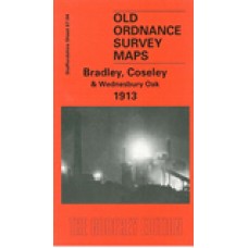
Staffordshire Sheet 67.04b Bradley, Coseley & Wednesbury Oak 1913 - published 2000; introduction by Angus Dunphy
We have published two versions of this map, showing how the area developed across the years. Most of Bradley - south of Bilston - is covered, and coverage extends southward to Wednesbury Oak and Coseley. Areas shown include Hall Green, Batmans Hill, Bradley Colliery, Lower Bradley, Hall Fields, Daisy Bank and Wednesbury Oak Colliery.
Features (1901 version) include the GWR OWW railway incl Daisy Bank station, a short stretch of the LNWR Stour Valley line inc Deepfields & Coseley station, Highfields Hall, Highfields Colliery (disused), Capponfield Colliery (disused), Hopyard Colliery (disused), old coal shafts, Birmingham Canal (Wolverhampton Level), Bradley Locks, Schoolfield Colliery (disused), Bradley Pumping Engine, Batmanshill Houses, many signs of old industry or mine workings, tramway, industrial sidings and tramways, Hardingsfield Colliery, Coseley Hall, Fullwoods End Colliery, Daisy Bank House, Christ Church etc. The 1913 version covers the same area; changes include a new site for Deepfields & Coseley station.
We include a directory of Bradley on the reverse of the 1901 version, and a commercial directory of Coseley on the 1913 map.
Bradley, Coseley and Wednesbury Oak 1913 - Old Ordnance Survey Maps - The Godfrey Edition
- Brand: Alan Godfrey Maps
- Product Code: St67.04b
- Availability: 1
-
£3.50
Related Products
Bilston 1901 - Old Ordnance Survey Maps - The Godfrey Edition
Here are the details of maps for Bilston:Staffs Sheet 62.16a Bilston 1884 - published 2011; intro by..
£3.50
Sedgley (NE) and Deepfields 1901 - Old Ordnance Survey Maps - The Godfrey Edition
Staffordshire Sheet 67.03 Sedgley (NE) & Deepfields 1901 - published 1998; introductio..
£3.50
Tipton 1904 - Old Ordnance Survey Maps - The Godfrey Edition
Staffordshire Sheet 67.08 Tipton 1904 - published 1989; introduction by Robin Pearson T..
£3.50
Wednesbury 1902 - Old Ordnance Survey Maps - The Godfrey Edition
Staffordshire Sheet 68.01 Wednesbury 1902 - published 1987; intro by John Maddison This..
£3.50
Bilston 1884 coloured - Old Ordnance Survey Maps - The Godfrey Edition
Here are the details of maps for Bilston:Staffs Sheet 62.16a Bilston 1884 - published 2011; intro by..
£4.00
Tipton 1884 - Old Ordnance Survey Maps - The Godfrey Edition
Staffs 67.08a Tipton 1884 - published 2018; intro by Angus Dunphy. ISBN.978-1-78721-148-3We have pub..
£3.50
Wednesbury 1913 - Old Ordnance Survey Maps - The Godfrey Edition
Staffs 68.01b Wednesbury 1913 - published 2018; intro by Barrie Trinder. ISBN.978-1-78721-129-2We ha..
£3.50
Bilston 1913 - Old Ordnance Survey Maps - The Godfrey Edition
Here are the details of maps for Bilston:Staffs Sheet 62.16a Bilston 1884 - published 2011; intro by..
£3.50
Tags: bradley, coseley, wednesbury oak


