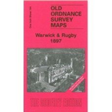
One Inch Sheet 184 Warwick & Rugby 1897 - published 2007; introduction by Barrie Trinder
This One Inch to the Mile map is taken from the early Coloured Edition. It covers the area from Warwick and Leamington eastward to Rugby, and from Kings Newnham southward to Ladbroke. The colopured edition maps are especially useful for those following the railways, and this includes the long closed Leamington-Rugby line, part of the Weedon branch and a stretch of the GCR line from Rugby southward. Other features include the Warwick & Napton Canal, Kenilworth, Southam. The map covers a good area of central east Warwickshire, with just fragments of Northants at the eastern edge. On the reverse we include a detailed map of the small town of Southam.
Warwick and Rugby 1897(Coloured edition) - Old Ordnance Survey Maps - The Godfrey Edition
- Brand: Alan Godfrey Maps
- Product Code: E184
- Availability: 2
-
£4.00
Related Products
Warwick Emscote All Saints Parish Register images - Bap 1861-1906, Mar 1861-1899, Burials 1873-1915 - Indexed - (Download)
Warwick Emscote All Saints Parish Registers These are copies of the original images from the..
£20.00
Warwick, St Paul Parish Register images - Bap 1849-1915, Mar 1849-1915, Burials 1849-1899 - Indexed - (Download)
Warwick, St Paul Parish Registers These are copies of the original images from the parish re..
£30.00
Warwick, St Nicholas; Parish Register images - Part 2 Bap 1784-1835, Mar 1754-1855, Bur 1784-1839 - Indexed (Download)
Warwick, St Nicholas; Parish Registers - Part 2Including Surname IndexThese are copies of the o..
£28.00
Warwick, St Nicholas; Parish Register images-Part 3 Bap 1835-1907, Mar 1855-1910, Bur 1839-1889 - Part Indexed (Download)
Warwick, St Nicholas; Parish Register - Part 3Including Surname IndexThese are copies of the or..
£30.00
Warwick, St Nicholas; Parish Register images- Parts 1, 2 and 3 - Bap 1539-1907, Banns 1831-1840, Mar 1539-1910, Bur 1539-1889 - Part Indexed ( Download)
Warwick, St Nicholas; Parish Registers - Parts 1, 2 and 3Including Surname IndexThese are copie..
£80.00


