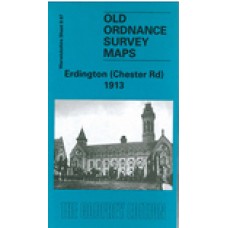
Warwickshire Sheet 8.07 Erdington (Chester Road) 1913 - published 2003; introduction by Roger Lea
This detailed map covers the northern part of Erdington, with coverage stretching from St Agnes Convent and Silver Birch Road northward to Wylde Green Hotel, and eastward to Penns Hall. Features include LNWR railway with Chester Road station, Penns Lane area, Destitute Orphans Home, Audley College, Chester Road area, tramway, mixture of terraced streets and villas in grounds, etc. The map includes the eastern part of Boldmere around Boldmere Road. On the reverse we include directories for Chester Road and for Boldmere.
Erdington (Chester Road) 1913 - Old Ordnance Survey Maps - The Godfrey Edition
- Brand: Alan Godfrey Maps
- Product Code: Wk08.07
- Availability: 3
-
£3.50
Related Products
Erdington (Chester Road) 1913 - Old Ordnance Survey Maps - The Godfrey Edition
Warwickshire Sheet 8.07 Erdington (Chester Road) 1913 - published 2003; introduction by Roger Lea ..
£3.50
Erdington (West) and Stockland Green 1913 - Old Ordnance Survey Maps - The Godfrey Edition
Warwickshire Sheet 8.10 Erdington (West) & Stockland Green 1913 - published 2002; introduction b..
£3.50
Erdington (East) 1913 - Old Ordnance Survey Maps - The Godfrey Edition
Warwickshire Sheet 8.11 Erdington (East) 1913 - published 2004; introduction by Roger Lea This de..
£3.50
Erdington (Birmingham) St. Barnabas' Church - Monumental Inscriptions - Download
Monumental Inscriptions Erdington (Birmingham) St. Barnabas' Church This is a downloadable..
£11.50
Erdington (Birmingham) Congregational Chapel, (Chapel-yard Only) - Monumental Inscriptions - Indexed -Download
Monumental Inscriptions Erdington (Birmingham) Congregational Chapel, (Chapel-yard Only) Now w..
£2.00
Tags: erdington


