Maps

Sparkhill and Greet 1913 - Old Ordnance Survey Maps - The Godfrey Edition
Here are the details of maps for Sparkhill, Greet and Tyseley:Warwicks 14.14a Sparkhill & Greet ..
£3.50
Sparkhill and Greet 1938 - Old Ordnance Survey Maps - The Godfrey Edition
Here are the details of maps for Sparkhill, Greet and Tyseley:Warwicks 14.14a Sparkhill & Greet ..
£3.50
Stafford 1879 - Old Ordnance Survey Maps - The Godfrey Edition
Staffordshire Sheet 37.11a Stafford 1879 - published 2011; intro by Derrick Pratt ..
£3.50
Stafford 1900 - Old Ordnance Survey Maps - The Godfrey Edition
Staffordshire Sheet 37.11 Stafford 1900 - published 1988; introduction by Joan Anslow T..
£3.50
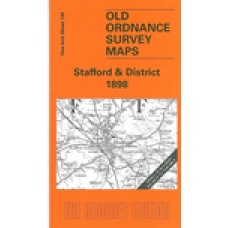
Stafford and District 1898 - Old Ordnance Survey Maps - The Godfrey Edition
One Inch Sheet 139 Stafford & District 1898 - published 2006; introduction by Barrie T..
£3.50
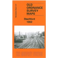
Stechford 1902 - Old Ordnance Survey Maps - The Godfrey Edition
Warwicks Sheet 14.07 Stechford 1902 - published 2014; intro by Malcolm Nixon. ISBN.978-1-8..
£3.50
Stoke on Trent 1923 - Old Ordnance Survey Maps - The Godfrey Edition
Here are the details of maps for Stoke on Trent:Staffs Sheet 18.01a Stoke, Shelton & Hartshill 1..
£3.50
Stoke upon Trent (South) 1898 - Old Ordnance Survey Maps - The Godfrey Edition
Staffordshire Sheet 18.05 Stoke upon Trent (South) 1898 - published 1993; introduction by ..
£3.50
Stoke upon Trent (South) 1923 - Old Ordnance Survey Maps - The Godfrey Edition
Here are the details of maps for Stoke on Trent (S):Staffs 18.05a Stoke upon Trent (South) 1898 - pu..
£3.50
Stoke, Shelton and Hartshill 1898 - Old Ordnance Survey Maps - The Godfrey Edition
Staffordshire Sheet 18.01 Stoke, Shelton & Hartshill 1898 - published 1993; introducti..
£3.50
Stone (North) 1900 - Old Ordnance Survey Maps - The Godfrey Edition
Here are the details of maps for Stone:Staffs 24.14 Stone (North) 1900 - published 2022; intro by Al..
£3.50
Stone (South) 1900 - Old Ordnance Survey Maps - The Godfrey Edition
Here are the details of maps for Stone:Staffs 24.14 Stone (North) 1900 - published 2022; intro by Al..
£3.50
Stourbridge (North) and Amblecote 1901 - Old Ordnance Survey Maps - The Godfrey Edition
Here are the details of maps for Stourbridge (N):Worcs 4.10a Stourbridge (North) & Amblecote 190..
£3.50
Stourbridge (North) and Amblecote 1914 - Old Ordnance Survey Maps - The Godfrey Edition
Here are the details of maps for Stourbridge (N):Worcs 4.10a Stourbridge (North) & Amblecote 190..
£3.50
Stourbridge (South) and Oldswinford 1914 - Old Ordnance Survey Maps - The Godfrey Edition
Here are the details of maps for Stourbridge (South):Worcs 4.14a Stourbridge (South) & Oldswinfo..
£3.50
Sutton Coldfield 1886 coloured - Old Ordnance Survey Maps - The Godfrey Edition
Here are the details of maps for Sutton Coldfield: Warks Sheet 4.15a Sutton Coldfield 1886 - publ..
£4.00
Sutton Coldfield 1913 - Old Ordnance Survey Maps - The Godfrey Edition
Warwickshire Sheet 4.15 Sutton Coldfield 1913 - published 1993; introduction by Roger Lea ..
£3.50
Talke Pits 1898 - Old Ordnance Survey Maps - The Godfrey Edition
Here are the details of the map for Talke:Staffordshire Sheet 11.03 Talke Pits 1898 - published 2020..
£3.50
Tame Bridge 1901 - Old Ordnance Survey Maps - The Godfrey Edition
Staffordshire Sheet 68.03 Tame Bridge 1901 - published 2009; introduction by Malcolm Nixon..
£3.50
Tamworth 1900 - Old Ordnance Survey Maps - The Godfrey Edition
Staffordshire Sheet 59.11 Tamworth 1900 - published 1990; introduction by Mabel Swift T..
£3.50

