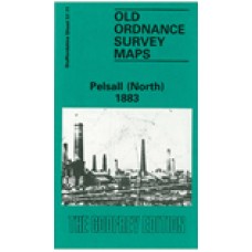
Staffordshire Sheet 57.11 Pelsall (North) 1883 - published 1995; introduction by A Tomkinson
This detailed map covers much of north Pelsall, an area that was semi-rural in the 1880s. However, there is a good smattering of industry and transport interest. Features include Pelsall Colliery (shafts 8, 9 and 10), Ryder's Hay Crossing and Sidings, section of LNWR line incl Norton Junction, Highbridge Row, Railway Colliery Hotel, Wyrley & Essington Canal, Pelsall Iron Works, Moat Farm, old coal shafts, Gilpin's Arm etc. On the reverse we include about half of the 1901 map for the area, covering the area around Pelsall Common.
Pelsall (North) 1883 - Old Ordnance Survey Maps - The Godfrey Edition
- Brand: Alan Godfrey Maps
- Product Code: St57.11
- Availability: 2
-
£3.50
Related Products
Shire Oak and Catshill 1901 - Old Ordnance Survey Maps - The Godfrey Edition
Staffordshire Sheet 57.12 Shire Oak & Catshill 1901 - published 2005; introduction by ..
£3.50
Pelsall (South) 1901 - Old Ordnance Survey Maps - The Godfrey Edition
Staffordshire Sheet 57.15 Pelsall (South) 1901 - published 2008; introduction by Malcolm N..
£3.50
Rushall and Pelsall Parish Register transcripts (download)
Rushall - Baptisms 1660 -1685, Marriages 1660 -1734, Burials 1660 -1770 and Pelsall - Baptisms..
£3.00
Pelsall High Heath Primitive Methodist Chapel Baptisms 1893-1979 (Download)
Pelsall High Heath Primitive Methodist ChapelBaptisms 1893-1979TranscriptionsNow with a clickable in..
£2.00
Pelsall Station Road Methodist Chapel - Baptisms 1866-1908 - Indexed (Download)
Wesleyan Methodist Chapel - Formerly Central Hall, Pelsall Station RoadBaptisms 1866-1908T..
£2.50
Pelsall Paradise Lane Primitive Methodist Chapel Baptisms 1882-1946, 1950-1965 - Indexed - (Download)
Pelsall Paradise Lane Primitive Methodist ChapelBaptisms 1882-1946, 1950-1965TranscriptionsNow with ..
£2.50
Tags: pelsall


