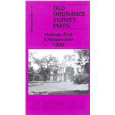
Staffordshire Sheet 11.10 Halmer End & Alsagers Bank 1922 - published 2023; intro by Barrie Trinder. ISBN.978-1-78721-626-6
This detailed map covers several small communities west of Newcastle-under-Lyme: Halmer End, Alsagers Bank, Wynbank, Victoria Place, Miles Green and part of Wood Lane. Features include Apedale Hall, Podmorehall Colliery with extensive mineral railway, Minnie Pit, the NSR Audley Branch with Halmerend station, Sandpit Footrail (pit), etc.
The map links up with Staffordshire Sheets 11.06 Audley to the north and sheet 11.11 Chesterton to the east.
Halmer End & Alsagers Bank 1922 - Old Ordnance Survey Maps - The Godfrey Edition
- Brand: Alan Godfrey Maps
- Product Code: St11.10
- Availability: 2
-
£3.50
Related Products
Tunstall 1898 - Old Ordnance Survey Maps - The Godfrey Edition
Staffordshire Sheet 11.08 Tunstall 1898 - published 1995; introduction by Malcolm Nixon ..
£3.50
Wolstanton 1898 - Old Ordnance Survey Maps - The Godfrey Edition
Staffordshire Sheet 11.16 Wolstanton 1898 - published 2007; introduction by Malcolm Nixon ..
£3.50
Burslem 1877(coloured edition) - Old Ordnance Survey Maps - The Godfrey Edition
Staffs Sheet 12.09a Burslem 1877 - published 2011; introduction by Derrick Pratt. *Coloured Edition*..
£4.00
Alsagers Bank Audley St. John’s Church - Monumental Inscriptions - Download
Monumental Inscriptions Alsagers Bank, Audley, St. John’s Church There are 2 downloadable pdf ..
£2.50
Tunstall 1877 - Old Ordnance Survey Maps - The Godfrey Edition
Staffs Sheet 11.08a Tunstall 1877 - published 2012; intro by Derrick Pratt We have publ..
£3.50
Kidsgrove (West) 1897 - Old Ordnance Survey Maps - The Godfrey Edition
Staffordshire Sheet 6.15 Kidsgrove (West) 1897 - published 2013; intro by Derrick Pratt. ISBN.978-1-..
£3.50
Kidsgrove 1898 - Old Ordnance Survey Maps - The Godfrey Edition
Staffordshire Sheet 6.16 Kidsgrove 1898 - published 2012; intro by Derrick Pratt. ISBN.978-1-84784-6..
£3.50
Audley 1898 - Old Ordnance Survey Maps - The Godfrey Edition
Staffordshire Sheet 11.06 Audley 1898 - published 2016; intro by Malcolm Nixon. ISBN.978-1-84784-992..
£3.50
Leek (West) 1923 - Old Ordnance Survey Maps - The Godfrey Edition
Here are the details of maps for Leek:Staffs Sheet 08.09 Leek (West) 1923 - published 2015..
£3.50
Leek (East) 1923 - Old Ordnance Survey Maps - The Godfrey Edition
Here are the details of maps for Leek:Staffs Sheet 08.09 Leek (West) 1923 - published 2015..
£3.50
Talke Pits 1898 - Old Ordnance Survey Maps - The Godfrey Edition
Here are the details of the map for Talke:Staffordshire Sheet 11.03 Talke Pits 1898 - published 2020..
£3.50
Tags: Halmer End, Alsagers Bank


