Here are the details of maps for Stoke on Trent:
Staffs Sheet 18.01a Stoke, Shelton & Hartshill 1898 - published 1993, minor revision 2015; intro by Alan Godfrey. ISBN.978-1-84784-877-2
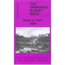
Staffs Sheet 18.01b Stoke on Trent 1923 - published 2022; intro by Alan Godfrey. ISBN.978-1-78721-571-9 - This map
We have published two versions of this map, showing how the area changed across the years.
The maps cover the northern half of Stoke upon Trent, with the southern part of Hanley, and westward to Hartshill and Cliff Vale.
Features include Trent & Mersey Canal, NSR railway with Stoke station, Newcastle Junction, goods sheds, Cliffe Vale Potteries, tile and earthenware manufactories, tramways, Convent, North Staffordshire Infirmary, Cemetery, NS Blind & Deaf School, Holy Trinity church Hartshill, county cricket ground, Basford Tileries, Albion Pottery, Etruscan Tile Works, Cauldon Ward, Shelton Hall, Bedford Works, Cauldon Place, Caldon Canal, Hanley Park, Cleveland House, St Mark's church (at top of map), sewage works, Winton pottery, etc.
The map links up with Staffordshire Sheets 12.13 Hanley to the north, 17.04 Newcastle to the west, 18.02 Hanley SE to the east and 18.05 Stoke South to the south.
Stoke on Trent 1923 - Old Ordnance Survey Maps - The Godfrey Edition
- Brand: Alan Godfrey Maps
- Product Code: St18.01b
- Availability: 2
-
£3.50
Related Products
Hanley and Etruria 1898 - Old Ordnance Survey Maps - The Godfrey Edition
Staffordshire Sheet 12.13 Hanley & Etruria 1898 - published 2008; introduction by Alan..
£3.50
Newcastle under Lyme 1898 - Old Ordnance Survey Maps - The Godfrey Edition
Staffordshire Sheet 17.04 Newcastle-under-Lyme 1898 - published 1989; introduction by Dave..
£3.50
Stoke upon Trent (South) 1898 - Old Ordnance Survey Maps - The Godfrey Edition
Staffordshire Sheet 18.05 Stoke upon Trent (South) 1898 - published 1993; introduction by ..
£3.50
Hanley and Etruria 1877(Coloured Edition) - Old Ordnance Survey Maps - The Godfrey Edition
Sheet 12.13a Hanley & Etruria 1877 - published 2011; introduction by Derrick Pratt. Coloured edi..
£4.00
Newcastle under Lyme 1877 - Old Ordnance Survey Maps - The Godfrey Edition
Here are the details of maps for Newcastle-under-Lyme: Staffordshire Sheet 17.04a Newcastle-..
£3.50
Stoke-On-Trent St.Peter Ad Vincula Parish Register Transcripts Part 1 1629-1688 (download)
Stoke-On-Trent St.Peter Ad Vincula Parish Register Transcripts Part 1 Baptisms, Marriage..
£3.00
Stoke-On-Trent St.Peter Ad Vincula Parish Register Transcripts Part 2 1689-1734 (download)
Stoke-On-Trent St.Peter Ad Vincula Parish Register Transcripts Part 2 Baptisms, Marriage..
£3.50
Shelton - Ridgeway Methodist Church Monumental Inscriptions (Download)
Shelton - Ridgeway Methodist Church Monumental Inscription Transcripts 1 page only This is ..
£2.00
Trentham Cemetery Monumental Inscriptions (Download)
Trentham Cemetery Monumental Inscription Transcripts 83 pages This is a downloadable PDF fi..
£4.00
Kidsgrove Monumental Inscriptions (Download)
Kidsgrove Church Yard Monumental Inscription Transcripts 40 pagesNow with clickable index ..
£2.50
Shelton St. Marks Church - Monumental Inscriptions - Download
Monumental Inscriptions Shelton St. Marks ChurchNow with clickable indexThis is a downloadable pd..
£2.50
Stoke on Trent & North Staffs Hebrew Cemetery Monumental Inscriptions - Indexed (Download)
MONUMENTAL INSCRIPTIONSOFSTOKE-ON-TRENT & NORTH STAFFORDSHIRE HEBREW CEMETERYA34 NEWCASTLE-UNDER..
£2.50
Hanley and Etruria 1923 - Old Ordnance Survey Maps - The Godfrey Edition
Here are the details of maps for Hanley:Sheet 12.13a Hanley & Etruria 1877 - published 2011; int..
£3.50
Newcastle under Lyme 1922 - Old Ordnance Survey Maps - The Godfrey Edition
Here are the details of maps for Newcastle-under-Lyme:Staffs Sheet 17.04a Newcastle-under-Lyme 1877 ..
£3.50
Stoke upon Trent (South) 1923 - Old Ordnance Survey Maps - The Godfrey Edition
Here are the details of maps for Stoke on Trent (S):Staffs 18.05a Stoke upon Trent (South) 1898 - pu..
£3.50


