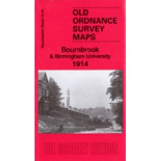
Here are the details of maps for Bournbrook:
Warwicks Sheet 13.16a Bournbrook 1902-11 - published 1996; intro by John Maddison. ISBN.978-0-85054-782-5
Warwicks Sheet 13.16b Bournbrook & Birmingham University - published 2019; intro by Barrie Trinder. ISBN.978-1-78721-261-9 This map
We have published two versions of this map, showing how the area changed across the years.
The maps cover the southern fringe of Edgbaston and much of Bournbrook and Selly Park, including the University area. Coverage stretches from Metchley Park eastward to Sir John's Road, and from Priory Road southward to Dartmouth Road.
Features include the Midland Railway (Selly Oak station is partially shown at the bottom margin), Worcester & Birmingham Canal, Sellyn Park, Bristol Road with tramway, Pebble Mill Farm, Edgbaston Pool, part of Edgbaston Park, Park House, cycle works, metal works, Selly Hill, Bourn Brook, Gun Barrels Inn, Rockingham House, small section of Dudley Canal, Selly Wick House etc. On the reverse we include extracts from early directories, together with an introduction to the history of the area.
The 1902-11 map is taken from the 'Inland Revenue Special Edition', basically a survey of 1902 with partial revision to 1911.
The map links up with sheets 13.12 Edgbaston to the north, 13.15 Harborne South to the west, 14.13 Moseley to the east, and Worcestershire sheet 10.04 Selly Oak to the south.
Bournbrook & Birmingham University 1914 - Old Ordnance Survey Maps - The Godfrey Edition
- Brand: Alan Godfrey Maps
- Product Code: Wk13.16B
- Availability: 2
-
£3.50
Related Products
Edgbaston 1901 - Old Ordnance Survey Maps - The Godfrey Edition
Here are the details of maps for Edgbaston:Warwicks 13.12a Edgbaston 1887 - published 2012; intro by..
£3.50
Harborne (South) 1901 - Old Ordnance Survey Maps - The Godfrey Edition
Warwickshire Sheet 13.15 Harborne (South) 1901 - published 2009; introduction by Malcolm Nixon Th..
£3.50
Moseley 1913 - Old Ordnance Survey Maps - The Godfrey Edition
Warwickshire Sheet 14.13 Moseley 1913 - published 1996; introduction by John Boynton This detaile..
£3.50
Edgbaston 1887 - Coloured - Old Ordnance Survey Maps - The Godfrey Edition
Here are the details of maps for Edgbaston:Warwicks 13.12a Edgbaston 1887 - published 2012; intro by..
£4.00
Moseley 1903 - Old Ordnance Survey Maps - The Godfrey Edition
Here are the details of maps for Moseley: Warwicks Sheet 14.13a Moseley 1903 - published 2015; in..
£3.50
Selly Oak and Bournville 1914 - Old Ordnance Survey Maps - The Godfrey Edition
Here are the details of maps for Selly Oak:Worcs Sheet 10.04a Selly Oak & Bournville 1903 - publ..
£3.50
Edgbaston 1914 - Old Ordnance Survey Maps - The Godfrey Edition
Here are the details of maps for Edgbaston:Warwicks 13.12a Edgbaston 1887 - published 2012; intro by..
£3.50
Selly Oak and Bournville 1937 - Old Ordnance Survey Maps - The Godfrey Edition
Here are the details of maps for Selly Oak:Worcs Sheet 10.04a Selly Oak & Bournville 1903 - publ..
£3.50
Tags: Bournbrook, Birmingham University


