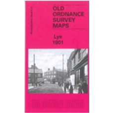
Here are the details of maps for Lye:
Worcs Sheet 4.11a Lye 1901 - published 2022; intro by Barrie Trinder. ISBN.978-1-78721-565-8 - This map
Worcs Sheet 4.11b Lye 1914 - published 1999; intro by John Boynton. ISBN.978-1-84151-046-0
We have published two versions of this map, showing how the area changed across the years. Each covers the western part of Cradley, Lye, a portion of Wollescote, and the southern part of Quarry Bank UDC. Coverage stretches from Hay Green eastward to Colleygate and from Forge Lane southward to Star Street, Lye.
Features include The Hayes, Hay Green, Anvil Works, Christ Church Lye, Hayes Works, Providential Works, Hayes Colliery, Cradleypark Colliery, Lower Delph Works, Cradley Colliery, Netherend Works, GWR Stourbridge Branch with Lye and Cradley stations, Globe Works, GWR Cradleypark Branch, Netherend, Homerhill Works, Homerhill Colliery, Lyde Green, Cradley Forge, Cradley Boiler Works, Dunn's Bank, The Thorns, Bedstead Works, Tintam Abbey Works, Meers Coppice, Fireclay Brick Works, old shafts, etc.
The map links up with Worcestershire sheets 4.10 Stourbridge North to the west, 4.12 Cradley South to the east, Staffordshire sheet 71.07 Brierley Hill East to the north.
Lye 1901 - Old Ordnance Survey Maps - The Godfrey Edition
- Brand: Alan Godfrey Maps
- Product Code: Wo04.11a
- Availability: 2
-
£3.50
Related Products
Stourbridge (North) and Amblecote 1901 - Old Ordnance Survey Maps - The Godfrey Edition
Here are the details of maps for Stourbridge (N):Worcs 4.10a Stourbridge (North) & Amblecote 190..
£3.50
Brierley Hill (East) with Merry Hill 1901 - Old Ordnance Survey Maps - The Godfrey Edition
Staffordshire Sheet 71.07 Brierley Hill (East) with Merry Hill 1901 - published 1998; intr..
£3.50
Lye, Stourbridge, Christ Church - Monumental Inscriptions - Download
Monumental Inscriptions Lye, Stourbridge, Christ Church There are 2 downloadable pdf files ..
£1.50
Brierley Hill (East) 1882 - Old Ordnance Survey Maps - The Godfrey Edition
Staffs Sheet 71.07a Brierley Hill (East) & Quarry Bank 1882 - published 2015; intro by..
£3.50
Sutton Coldfield 1886 coloured - Old Ordnance Survey Maps - The Godfrey Edition
Here are the details of maps for Sutton Coldfield: Warks Sheet 4.15a Sutton Coldfield 1886 - publ..
£4.00
Stourbridge (North) and Amblecote 1914 - Old Ordnance Survey Maps - The Godfrey Edition
Here are the details of maps for Stourbridge (N):Worcs 4.10a Stourbridge (North) & Amblecote 190..
£3.50
Lye, 1851 census Transcript; Indexed - Download
Lye 1851 Census TranscriptIncluding Surname IndexThis is a downloadable PDF file, approx 2,466K..
£3.00
Tags: lye


