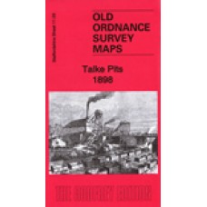
Here are the details of the map for Talke:
Staffordshire Sheet 11.03 Talke Pits 1898 - published 2020; intro by Barrie Trinder.
This detailed map covers Talke, Talke Pits and the area SW of Kidsgrove.
Features include three branches of the North Staffordshire Railway - Talk o' th' Hill Branch, Jamage Branch, Audley Branch - and three collieries - Birchenwood, Jamage, Talk o'th' Hill, as well as the village of Talke Pits which is in the centre of the maps. Talke village is at the top of the map.
The map links up with Staffordshire Sheets 6.15 Kidsgrove W to the north, 11.04 Goldenhill to the east.
Talke Pits 1898 - Old Ordnance Survey Maps - The Godfrey Edition
- Brand: Alan Godfrey Maps
- Product Code: St11.03
- Availability: 2
-
£3.50
Related Products
Longport and Porthill 1898 - Old Ordnance Survey Maps - The Godfrey Edition
Staffordshire Sheet 11.12 Longport & Porthill 1898 - published 2004; introduction by M..
£3.50
Smallthorne and East Tunstall 1922 - Old Ordnance Survey Maps - The Godfrey Edition
Staffordshire Sheet 12.05 Smallthorne & East Tunstall 1922 - published 1996; introduct..
£3.50
Smallthorne and East Tunstall 1898 - Old Ordnance Survey Maps - The Godfrey Edition
Staffs Sheet 12.05a Smallthorne & East Tunstall 1898 - published 2012; intro by Derric..
£3.50
Great Chell 1876 - Old Ordnance Survey Maps - The Godfrey Edition
Staffordshire Sheet 12.01 Great Chell 1876 - published 2011; intro by Malcolm Nixon Thi..
£3.50
Halmer End & Alsagers Bank 1922 - Old Ordnance Survey Maps - The Godfrey Edition
Staffordshire Sheet 11.10 Halmer End & Alsagers Bank 1922 - published 2023; intro by Barrie Trin..
£3.50
Chesterton 1922 - Old Ordnance Survey Maps - The Godfrey Edition
Staffordshire Sheet 11.11 Chesterton 1922 - published 2023; intro by Barrie Trinder. ISBN.978-1-7872..
£3.50
Tags: Talke


