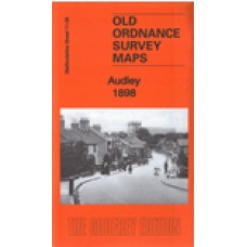
Staffordshire Sheet 11.06 Audley 1898 - published 2016; intro by Malcolm Nixon. ISBN.978-1-84784-992-2
This detailed map covers the village of Audley and extends eastward to Audley Colliery.
Features include Audley Colliery, Butters Green, Diglake Junction, Audley station, Boon Hill, Boyles Hall Colliery, Raven's Lane, Boyles Hall, Wereton, Wall Farm, Hougher Wall, St James church, Townhouse etc. A 1912 directory of Audley is included on the reverse.
Audley 1898 - Old Ordnance Survey Maps - The Godfrey Edition
- Brand: Alan Godfrey Maps
- Product Code: St11.06
- Availability: 2
-
£3.50
Related Products
Longport and Porthill 1898 - Old Ordnance Survey Maps - The Godfrey Edition
Staffordshire Sheet 11.12 Longport & Porthill 1898 - published 2004; introduction by M..
£3.50
Smallthorne and East Tunstall 1922 - Old Ordnance Survey Maps - The Godfrey Edition
Staffordshire Sheet 12.05 Smallthorne & East Tunstall 1922 - published 1996; introduct..
£3.50
Smallthorne and East Tunstall 1898 - Old Ordnance Survey Maps - The Godfrey Edition
Staffs Sheet 12.05a Smallthorne & East Tunstall 1898 - published 2012; intro by Derric..
£3.50
Great Chell 1876 - Old Ordnance Survey Maps - The Godfrey Edition
Staffordshire Sheet 12.01 Great Chell 1876 - published 2011; intro by Malcolm Nixon Thi..
£3.50
Halmer End & Alsagers Bank 1922 - Old Ordnance Survey Maps - The Godfrey Edition
Staffordshire Sheet 11.10 Halmer End & Alsagers Bank 1922 - published 2023; intro by Barrie Trin..
£3.50
Chesterton 1922 - Old Ordnance Survey Maps - The Godfrey Edition
Staffordshire Sheet 11.11 Chesterton 1922 - published 2023; intro by Barrie Trinder. ISBN.978-1-7872..
£3.50
Tags: Audley


