Staffs Sheet 12.09a Burslem & Cobridge 1877 - published 2011; intro by Derrick Pratt. ISBN.978-1-84784-462-0
Staffs Sheet 12.09b Burslem & Cobridge 1898 - published 1994; intro by Alan Godfrey. ISBN.978-0-85054-670-5
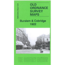
Staffs Sheet 12.09c Burslem & Cobridge 1922 - published 2022; intro by Barrie Trinder. ISBN.978-1-78721-563-4 - This map
We have published three versions of this map, showing how this busy area changed across the years. The 1877 version is in full colour, taken from the beautiful 1st edition handcoloured edition.
The maps cover most of Burslem, one of the Potteries 'Six Towns', together with the smaller settlements of Cobridge and Sneyd Green. Coverage stretches from Newport Lane eastward to Burslem Cemetery, and from Moor Lane southward to Port Vale football ground.
The many features include NSR Potteries Loop Line with Cobridge and Burslem stations, stretch of Trent & Mersey Canal, Burslem Canal, St Paul's church, Newport Pottery, Mersey Pottery, numerous earthenware manufactories, Hill Works, Town Hall, Butchers' Market, St John's church, NSR Grange Branch, Grange Colliery, Grange Farm, Sneyd Colliery & Brick Works, Adelaide Pottery, Port Vale Football Ground, Haywood Home hospital, old coal shafts, Burslem Cemetery, old ironstone shafts, Sneyd Green, tramways, etc.
The map links up with Staffordshire Sheets 12.05 Smallthorne to the north, 11.12 Longport to the west, and 12.13 Hanley to the south.
Burslem & Cobridge 1922 - Old Ordnance Survey Maps - The Godfrey Edition
- Brand: Alan Godfrey Maps
- Product Code: ST12.09C
- Availability: 1
-
£3.50
Related Products
Longport and Porthill 1898 - Old Ordnance Survey Maps - The Godfrey Edition
Staffordshire Sheet 11.12 Longport & Porthill 1898 - published 2004; introduction by M..
£3.50
Smallthorne and East Tunstall 1922 - Old Ordnance Survey Maps - The Godfrey Edition
Staffordshire Sheet 12.05 Smallthorne & East Tunstall 1922 - published 1996; introduct..
£3.50
Hanley and Etruria 1898 - Old Ordnance Survey Maps - The Godfrey Edition
Staffordshire Sheet 12.13 Hanley & Etruria 1898 - published 2008; introduction by Alan..
£3.50
Hanley and Etruria 1877(Coloured Edition) - Old Ordnance Survey Maps - The Godfrey Edition
Sheet 12.13a Hanley & Etruria 1877 - published 2011; introduction by Derrick Pratt. Coloured edi..
£4.00
Smallthorne and East Tunstall 1898 - Old Ordnance Survey Maps - The Godfrey Edition
Staffs Sheet 12.05a Smallthorne & East Tunstall 1898 - published 2012; intro by Derric..
£3.50
Great Chell 1876 - Old Ordnance Survey Maps - The Godfrey Edition
Staffordshire Sheet 12.01 Great Chell 1876 - published 2011; intro by Malcolm Nixon Thi..
£3.50
Burslem St.John The Baptist Parish Register Transcripts 1578-1812 (download)
Burslem St.John The Baptist Parish Register Transcripts Part 1 Baptisms and Burials&nbs..
£7.50
Burslem Staffordshire Parish Register transcripts - Baptisms 1578-1837, Marriages 1578-1837, Burials 1578-1837 - Download
Burslem St.John The BaptistParish Register TranscriptsPart 1 Baptisms, Marriages and Burials&nb..
£12.50
Halmer End & Alsagers Bank 1922 - Old Ordnance Survey Maps - The Godfrey Edition
Staffordshire Sheet 11.10 Halmer End & Alsagers Bank 1922 - published 2023; intro by Barrie Trin..
£3.50
Chesterton 1922 - Old Ordnance Survey Maps - The Godfrey Edition
Staffordshire Sheet 11.11 Chesterton 1922 - published 2023; intro by Barrie Trinder. ISBN.978-1-7872..
£3.50
Hanley and Etruria 1923 - Old Ordnance Survey Maps - The Godfrey Edition
Here are the details of maps for Hanley:Sheet 12.13a Hanley & Etruria 1877 - published 2011; int..
£3.50
Tags: burslem


