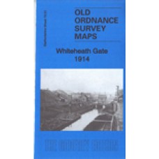
Here are the details of maps for Whiteheath Gate:
Staffs 72.01 Whiteheath Gate 1902 - published 1989; intro by John Maddison. ISBN.978-0-85054-260-8
Staffs 72.01 Whiteheath Gate 1914 - published 2019; intro by Barrie Trinder. ISBN.978-1-78721-228-2 This map
We have published two versions of this map, showing how the area changed across the years. Each covers the same area, which includes sections of both Worcestershire (sheet 5.01) and Staffordshire (sheet 72.01) including the eastern part of Rowley Regis and western part of Oldbury. No major community is shown on the map, the main settlement being Whiteheath Gate.
Features on the map include the Titford Canal, the Causeway Green Branch canal, Titford Bridge, Hartland Colliery, Park House Brick Works, Radnall Brick Works, Newbury Lane Brick Works, Ramrod Hall, Ramrod Hall Brick Works, Rowleyhall Colliery, Tippity Green, Perry's Lake, Prospect Quarry, Gadd's Green, Turner's Hill, Cloudland, Throne, Ramrod Colliery, Portway, fever hospital, Ivyhouse Farm, several industrial tramways etc.
The map links up with Staffordshire sheet 72.02 Langley to the east, 68.13 Brades Village to the north, 71.04 Netherton to the west and 72.05 Rowley Regis to the south.
Whiteheath Gate 1914 - Old Ordnance Survey Maps - The Godfrey Edition
- Brand: Alan Godfrey Maps
- Product Code: St72.01B
- Availability: 2
-
£3.50
Related Products
Birmingham (West) 1914 - Old Ordnance Survey Maps - The Godfrey Edition
Warwickshire Sheet 13.08 Birmingham (West) 1914 - published 2003; introduction by Alan Godfrey Th..
£3.50
Harborne 1901 - Old Ordnance Survey Maps - The Godfrey Edition
Here are the details of maps for Harborne:Warwicks Sheet 13.11a Harborne 1901 - published 1989; intr..
£3.50
Smethwick 1901 - Old Ordnance Survey Maps - The Godfrey Edition
Here are the details of maps for Smethwick:Staffs 72.03a Smethwick 1901 - published 1987; intro by J..
£3.50
Warley 1902 - Old Ordnance Survey Maps - The Godfrey Edition
Staffordshire 72.06 Warley 1902 - published 1988; introduction by Steve Cemm This detai..
£3.50
Birmingham (West) 1887 - Coloured - Old Ordnance Survey Maps - The Godfrey Edition
Warwickshire Sheet 13.08a Birmingham (West) 1887 - published 2012; intro by Barr..
£4.00
Smethwick 1913 - Old Ordnance Survey Maps - The Godfrey Edition
Here are the details of maps for Smethwick:Staffs 72.03a Smethwick 1901 - published 1987; intro by J..
£3.50
Harborne 1938 - Old Ordnance Survey Maps - The Godfrey Edition
Here are the details of maps for Harborne:Warwicks Sheet 13.11a Harborne 1901 - published 1989; intr..
£3.50
Smethwick 1938 - Old Ordnance Survey Maps - The Godfrey Edition
Here are the details of maps for Smethwick:Staffs 72.03a Smethwick 1901 - published 1987; intro by J..
£3.50
Harborne 1914 - Old Ordnance Survey Maps - The Godfrey Edition
Here are the details of maps for Harborne:Warwicks Sheet 13.11a Harborne 1901 - published 1989; intr..
£3.50
Tags: Whiteheath Gate


