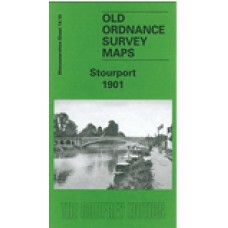
Worcestershire Sheet 14.10 Stourport 1901 - published 2002; introduction by Barrie Trinder
This detailed map of Stourport is double-sided for maximum coverage.
The main map covers the centre and north of the town, with coverage extending north of the railway to include the Newtown area and part of Upper Mitton. Features include railway with station, Staffordshire & Worcestershire Canal, Bullocklane Bridge, Upper Milton Bridge, Mitton Gardens, enamel works, carpet mill, St Michael's church, iron foundry, Moor Hall, Lickhill Lodge, corn mill, tin works, tramway, etc.
On the reverse we include part of adjacent sheet 14.14, extending coverage southward to include River Severn with basins, vinegar works, Severn Valley Works, Tontine Buildings, dry dock, Areley Kings, St Bartholomew's church, Areley Court, Areley House, Walshe's Farm.
Stourport 1901 - Old Ordnance Survey Maps - The Godfrey Edition
- Brand: Alan Godfrey Maps
- Product Code: Wo14.10
- Availability: 1
-
£3.50
Related Products
Stourbridge (South) and Oldswinford 1914 - Old Ordnance Survey Maps - The Godfrey Edition
Here are the details of maps for Stourbridge (South):Worcs 4.14a Stourbridge (South) & Oldswinfo..
£3.50
Wollaston 1901 - Old Ordnance Survey Maps - The Godfrey Edition
Worcestershire Sheet 4.09 Wollaston 1901 - published 1998; introduction by John Boynton ..
£3.50
Lye 1914 - Old Ordnance Survey Maps - The Godfrey Edition
Worcestershire Sheet 4.11 Lye 1914 - published 1999; introduction by John Boynton This ..
£3.50
Wordsley 1901 - Old Ordnance Survey Maps - The Godfrey Edition
Staffordshire Sheet 71.05 Wordsley 1901 - published 1998; introduction by Stan Hill Thi..
£3.50
Brierley Hill (West) and Brettell Lane 1901 - Old Ordnance Survey Maps - The Godfrey Edition
Staffordshire Sheet 71.06B Brierley Hill (West) & Brettell Lane 1901 - published 1997;..
£3.50
Brierley Hill (West) 1882 - Old Ordnance Survey Maps - The Godfrey Edition
Staffordshire Sheet 71.06A Brierley Hill (West) 1881 - published 2015; intro by Angus..
£3.50
Kidderminster and Stourport on Severn - Cassini Past and Present Map - 4 maps from 4 periods
Kidderminster and Stourport on Severn Cassini Map - Past and Present series - 4 maps from 4 ..
£7.99
Stourbridge (South) and Oldswinford 1901 - Old Ordnance Survey Maps - The Godfrey Edition
Here are the details of maps for Stourbridge (South):Worcs 4.14a Stourbridge (South) & Oldswinfo..
£3.50
Lye 1901 - Old Ordnance Survey Maps - The Godfrey Edition
Here are the details of maps for Lye:Worcs Sheet 4.11a Lye 1901 - published 2022; intro by Barrie Tr..
£3.50
Tags: stourport


